
Compare instead of inspect.
Aerial corridor inspection for everyone who runs a whole network. We show you the few spots that have moved since the last flight.
One map shows you where to go.
Why sift through mountains of data when one map will do? We fly your corridor at fixed intervals. A UHD camera and LiDAR survey it, every time on the same path. From the second flight on, the heatmap shows you where something has moved. More about the heatmap
All we need from you is the line.
Name the line
A corridor or an area on the map.
We fly
At fixed intervals, always the same path, as the operator with our own permit.
Open the heatmap
First after the second flight, then after every flight.
Until now you had to choose.
Fast, precise or current. Never all three at once.
the foot patrol
Thorough, but outdated.
By the time the last kilometre is walked, the first one is old again.
the helicopter
Fast, but coarse.
It covers the line in a day. It just doesn't see a centimetre while doing it.
the drone
Precise, but not for long.
It has to land before you finish your coffee. A corridor means swapping batteries, again and again.
TENEO|E
All three.
One flight, the full picture. Fast, because one flight captures the whole line, twelve hours at a stretch. Precise, because a UHD camera and LiDAR are on board. Current, because every flight takes the same path and is compared with the last. The lifting gas lifts, the motors push. If the power fails, it sinks slowly, it does not fall.
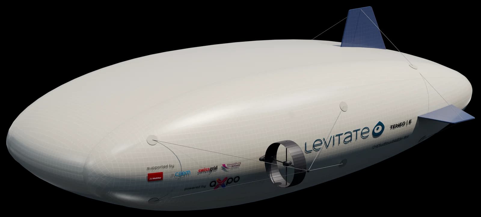
TENEO|E · 5 m · lifting gas + aerodynamics · 12 h
Who already trusts us.
Grid operator · Switzerland
Pilot operations on the line.
Railway operator · national
The technology under test, along their own line.
Geodata and structures
Partnership for risk analysis and structural monitoring.
With Levitate, the economical capture of large perimeters is the key to unlocking completely new services in risk management and construction monitoring.
 Damian Steffen · Member of the Executive Board · geoformer igp AG


Let's talk about your line.


Andi and Gabi make time for your corridor.